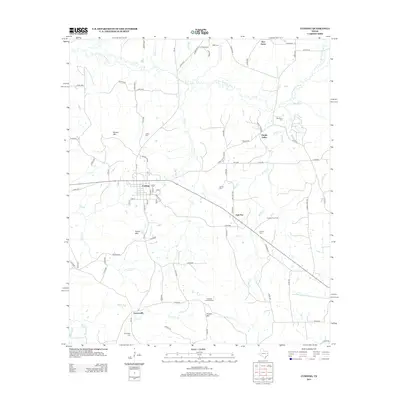
2013 Map of Cushing
USGS Topo · Published 2013About this map
The town of Cushing serves as the central hub of this East Texas survey, showing a structured grid of streets including Elm St and Pine St near the intersection of several county routes. The surrounding landscape in Nacogdoches County is defined by a dense network of tributaries flowing toward the E Fork Angelina River, which winds across the northern reaches. Scattered rural settlements such as Looneyville to the south and Oak Flat to the east illustrate the enduring residential pattern of the region.
Find a feature on this map
91 named features on this map. Tap any name to fly to it.
Don’t see what you’re looking for? This feature index may not catch every label — zoom into the map to look around manually.
Map Details
Editions of this 2013 Cushing Map
This is the sole edition of this map. No revisions or reprints were ever made.
Other maps of this area

1943 · Cushing
USGS Topo · 1:62,500

1945 · Cushing
USGS Topo · 1:62,500

1952 · Douglass
USGS Topo · 1:62,500

1952 · Nacogdoches
USGS Topo · 1:62,500

1953 · Palestine
USGS Topo · 1:250,000

1957 · Palestine
USGS Topo · 1:250,000

1960 · Mount Enterprise
USGS Topo · 1:62,500

1973 · Cushing
USGS Topo · 1:24,000
1973 · Laneville
USGS Topo · 1:24,000
1973 · New Salem
USGS Topo · 1:24,000