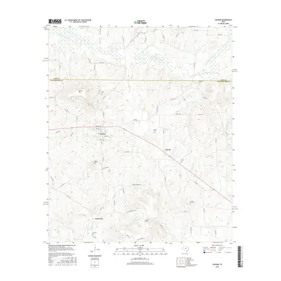
2016 Map of Cushing
USGS Topo · Published 2016About this map
Cushing serves as the primary hub of this East Texas landscape, where the borders of Nacogdoches and Rusk counties meet. The terrain is defined by a series of prominent elevations such as Button Mtn, Denny Mtn, and Flower Mtn, which rise above the drainage basins of the E Fork Angelina River and Little Bayou Loco. Small communities like Oak Flat and Looneyville are connected by a network of farm-to-market roads and county routes, reflecting a rural settlement pattern deeply rooted in the land.
Find a feature on this map
82 named features on this map. Tap any name to fly to it.
Don’t see what you’re looking for? This feature index may not catch every label — zoom into the map to look around manually.
Map Details
Editions of this 2016 Cushing Map
This is the sole edition of this map. No revisions or reprints were ever made.
Other maps of this area

1943 · Cushing
USGS Topo · 1:62,500

1945 · Cushing
USGS Topo · 1:62,500

1952 · Douglass
USGS Topo · 1:62,500

1952 · Nacogdoches
USGS Topo · 1:62,500

1953 · Palestine
USGS Topo · 1:250,000

1957 · Palestine
USGS Topo · 1:250,000

1960 · Mount Enterprise
USGS Topo · 1:62,500

1973 · Cushing
USGS Topo · 1:24,000
1973 · Laneville
USGS Topo · 1:24,000
1973 · New Salem
USGS Topo · 1:24,000