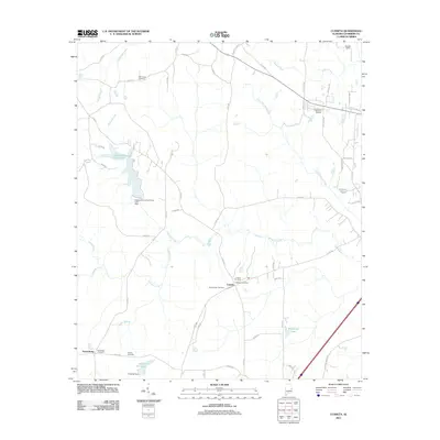
2011 Map of Cusseta
USGS Topo · Published 2011About this map
Cusseta serves as the central hub of this Chambers County landscape, where the Cusseta Post Office and Cusseta Cemetery anchor the local community. The area is defined by its extensive network of creeks and managed water bodies, including the large Chambers County State Lake and smaller reservoirs like Flint Hill Lake and Kilpatrick Lake. Genealogists will find significant value in the numerous burial grounds scattered across the terrain, from Mount Nebo Cemetery near the main settlement to the Robertson Cemetery and Simms Cemetery located further west near Tuckersburg. The drainage pattern is complex, led by Oseligee Creek and Wildcat Creek, which carve through the countryside alongside a dense grid of county roads that replaced earlier rural tracks.
Find a feature on this map
58 named features on this map. Tap any name to fly to it.
Don’t see what you’re looking for? This feature index may not catch every label — zoom into the map to look around manually.
Map Details
Editions of this 2011 Cusseta Map
This is the sole edition of this map. No revisions or reprints were ever made.
Other maps of this area

1907 · Opelika
USGS Topo · 1:125,000

1909 · Opelika
USGS Topo · 1:125,000

1955 · Phenix City
USGS Topo · 1:250,000

1957 · Phenix City
USGS Topo · 1:250,000

1958 · Phenix City
USGS Topo · 1:250,000
1964 · Lanett North
USGS Topo · 1:24,000

1964 · Lanett South
USGS Topo · 1:24,000
1965 · Beulah
USGS Topo · 1:24,000

1970 · Opelika East
USGS Topo · 1:24,000
1971 · Cusseta
USGS Topo · 1:24,000