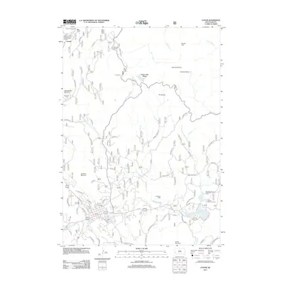
2012 Map of Custer
USGS Topo · Published 2012About this map
Thunderhead Mountain and the Crazy Horse Carving anchor the western edge of this survey, which documents the complex terrain and road network near the heart of the Black Hills. The landscape is defined by granite formations like The Needles, Cathedral Spires, and the prominent Harney Peak to the northeast. Near the center, Sylvan Lake Resort and its namesake Sylvan Lake serve as a focal point for the many forest roads and trails, including the Sunday Gulch and Hood Tunnel area.
Find a feature on this map
70 named features on this map. Tap any name to fly to it.
Don’t see what you’re looking for? This feature index may not catch every label — zoom into the map to look around manually.
Map Details
Editions of this 2012 Custer Map
This is the sole edition of this map. No revisions or reprints were ever made.
Other maps of this area

1894 · Hermosa
USGS Topo · 1:125,000

1896 · Harney Peak
USGS Topo · 1:125,000

1901 · Hermosa
USGS Topo · 1:125,000

1901 · Harney Peak
USGS Topo · 1:125,000

1954 · Iron Mountain
USGS Topo · 1:24,000

1954 · Fourmile
USGS Topo · 1:24,000
1954 · Mount Rushmore
USGS Topo · 1:24,000

1954 · Custer
USGS Topo · 1:24,000

1954 · Hill City
USGS Topo · 1:24,000

1954 · Berne
USGS Topo · 1:24,000