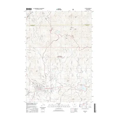
2016 Map of Custer
USGS Topo · Published 2016About this map
Custer serves as the focal point of this Black Hills survey, situated south of the sprawling Black Hills National Forest. The landscape is dominated by high-elevation granite formations and peaks, including the prominent Black Elk Peak and the striking geologic features of The Needles. In the northern reaches, the small settlement of Oreville sits along Spring Creek, while the town of Custer is anchored by a traditional grid of streets like Harney Street and Crook Street.
Find a feature on this map
54 named features on this map. Tap any name to fly to it.
Don’t see what you’re looking for? This feature index may not catch every label — zoom into the map to look around manually.
Map Details
Editions of this 2016 Custer Map
This is the sole edition of this map. No revisions or reprints were ever made.
Other maps of this area

1894 · Hermosa
USGS Topo · 1:125,000

1896 · Harney Peak
USGS Topo · 1:125,000

1901 · Hermosa
USGS Topo · 1:125,000

1901 · Harney Peak
USGS Topo · 1:125,000

1954 · Iron Mountain
USGS Topo · 1:24,000

1954 · Fourmile
USGS Topo · 1:24,000
1954 · Mount Rushmore
USGS Topo · 1:24,000

1954 · Custer
USGS Topo · 1:24,000

1954 · Hill City
USGS Topo · 1:24,000

1954 · Berne
USGS Topo · 1:24,000