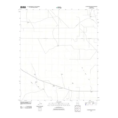
2010 Map of Custer Mountain
USGS Topo · Published 2010About this map
Custer Mountain and Old Baldy rise above the high plains of Lea County, marking a landscape defined by ranching operations and water management. This early 21st-century survey reveals the critical infrastructure of the arid West, where family names are tied to essential water sources like West Dublin Windmill, Humphreys Windmill, and Coats Windmill. These landmarks, along with the Whitten Ranch and Dinwiddie Ranch, document the persistent legacy of cattle ranching in the region.
Find a feature on this map
17 named features on this map. Tap any name to fly to it.
Don’t see what you’re looking for? This feature index may not catch every label — zoom into the map to look around manually.
Map Details
Editions of this 2010 Custer Mountain Map
This is the sole edition of this map. No revisions or reprints were ever made.
Other maps of this area

1954 · Hobbs
USGS Topo · 1:250,000

1958 · Hobbs
USGS Topo · 1:250,000

1963 · Oil Center
USGS Topo · 1:62,500

1969 · Jal NW
USGS Topo · 1:24,000

1969 · Jal
USGS Topo · 1:24,000

1969 · Rattlesnake Canyon
USGS Topo · 1:24,000

1973 · Javelina Basin
USGS Topo · 1:24,000

1973 · Custer Mountain
USGS Topo · 1:24,000
1973 · Andrews Place
USGS Topo · 1:24,000
1973 · Woodley Flat
USGS Topo · 1:24,000