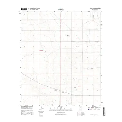
2017 Map of Custer Mountain
USGS Topo · Published 2017About this map
Custer Mountain and Old Baldy dominate this arid landscape in Lea County, New Mexico, where the terrain is marked by distinctive ephemeral water sources and rugged draws. The presence of Old Lake, Sewell Tank, and the Dinwiddie Tanks points to the essential infrastructure required for ranching and survival in this desert environment. Human activity in the area is further evidenced by the Jal Rifle Range and a network of rural roads such as Cooper Cemetery Rd, which hints at local history and family landmarks often sought by genealogists.
Find a feature on this map
17 named features on this map. Tap any name to fly to it.
Don’t see what you’re looking for? This feature index may not catch every label — zoom into the map to look around manually.
Map Details
Editions of this 2017 Custer Mountain Map
This is the sole edition of this map. No revisions or reprints were ever made.
Other maps of this area

1954 · Hobbs
USGS Topo · 1:250,000

1958 · Hobbs
USGS Topo · 1:250,000

1963 · Oil Center
USGS Topo · 1:62,500

1969 · Jal NW
USGS Topo · 1:24,000

1969 · Jal
USGS Topo · 1:24,000

1969 · Rattlesnake Canyon
USGS Topo · 1:24,000

1973 · Javelina Basin
USGS Topo · 1:24,000

1973 · Custer Mountain
USGS Topo · 1:24,000
1973 · Andrews Place
USGS Topo · 1:24,000
1973 · Woodley Flat
USGS Topo · 1:24,000