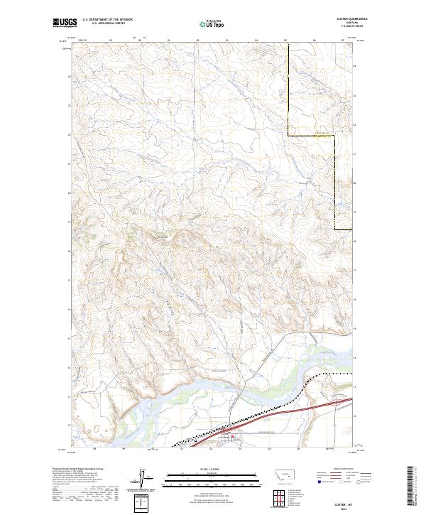
2024 Map of Custer
USGS Topo · Published 2024About this map
The Yellowstone River cuts through the southern reaches of this landscape, defining the corridor for the town of Custer. This settlement, established at the junction of rail and river routes, serves as the primary hub for the surrounding ranching and agricultural lands. North of the river, the terrain ascends into a series of coulees and breaks, including the prominent Fivemile Hill and the deep drainage of Big Coulee. Historically significant travel ways like the Musselshell Trail Rd trace the path from the river valley toward the northern uplands, following the natural contours of the land.
Find a feature on this map
32 named features on this map. Tap any name to fly to it.
Don’t see what you’re looking for? This feature index may not catch every label — zoom into the map to look around manually.
Map Details
Editions of this 2024 Custer Map
This is the sole edition of this map. No revisions or reprints were ever made.
Other maps of this area

1954 · Forsyth
USGS Topo · 1:250,000

1957 · Forsyth
USGS Topo · 1:250,000

1958 · Forsyth
USGS Topo · 1:250,000

1960 · Bighorn
USGS Topo · 1:24,000

1960 · Coal Bank Creek
USGS Topo · 1:24,000

1960 · Custer
USGS Topo · 1:24,000

1960 · Rancher Cemetery
USGS Topo · 1:24,000

1960 · Marsh Coulee
USGS Topo · 1:24,000

1960 · Waco
USGS Topo · 1:24,000
1960 · Mission Creek
USGS Topo · 1:24,000