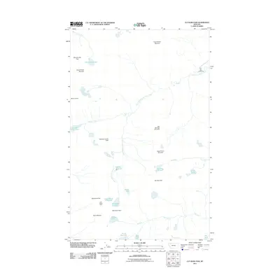
2011 Map of Cut Bank Pass
USGS Topo · Published 2011About this map
Cut Bank Pass and Pitamakan Pass serve as the primary trans-mountain crossings in this alpine environment, connecting the drainage basins of the North Fork Cut Bank Creek and the Dry Fork. This 2011 survey reveals a landscape dominated by high-altitude glacial features, including a remarkable concentration of cirque lakes such as Medicine Grizzly Lake, Morning Star Lake, and the poetically named Seven Winds of the Lake. The area's hydrology is defined by the headwaters of Medicine Owl Creek and Lake Creek, with Atlantic Falls marking a significant drop along the eastern slopes. Human infrastructure is nearly absent from this terrain, limited primarily to the Cut Bank Campground at the edge of the creek. Significant peaks like McClintock Peak, Bad Marriage Mountain, and Eagle Plume Mountain ring the high valleys, providing a detailed view of the continental divide's complex topography.
Find a feature on this map
31 named features on this map. Tap any name to fly to it.
Don’t see what you’re looking for? This feature index may not catch every label — zoom into the map to look around manually.
Map Details
Editions of this 2011 Cut Bank Pass Map
This is the sole edition of this map. No revisions or reprints were ever made.
Other maps of this area

1901 · Browning
USGS Topo · 1:125,000

1903 · Browning
USGS Topo · 1:125,000

1904 · Chief Mountain
USGS Topo · 1:125,000

1913 · Marias Pass
USGS Topo · 1:125,000

1914 · Nyack
USGS Topo · 1:125,000

1938 · Chief Mountain
USGS Topo · 1:125,000

1960 · Cut Bank
USGS Topo · 1:250,000

1963 · Cut Bank
USGS Topo · 1:250,000

1964 · Cut Bank
USGS Topo · 1:250,000
1964 · Mount Saint Nicholas
USGS Topo · 1:24,000