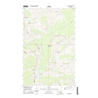
2017 Map of Cut Bank Pass
USGS Topo · Published 2017About this map
Glacier National Park defines this landscape of extreme high-altitude hydrography and dramatic ridgelines. The area is a critical hydrological junction where Atlantic Cr and Dry Fork drainage systems originate from snowmelt-fed alpine basins. Notable elevations include Triple Divide and Medicine Grizzly Peak, while a series of high mountain gaps—Cut Bank Pass, Pitamakan Pass, and Dawson Pass—represent the historic transit corridors through this segment of the Continental Divide.
Find a feature on this map
41 named features on this map. Tap any name to fly to it.
Don’t see what you’re looking for? This feature index may not catch every label — zoom into the map to look around manually.
Map Details
Editions of this 2017 Cut Bank Pass Map
This is the sole edition of this map. No revisions or reprints were ever made.
Other maps of this area

1901 · Browning
USGS Topo · 1:125,000

1903 · Browning
USGS Topo · 1:125,000

1904 · Chief Mountain
USGS Topo · 1:125,000

1913 · Marias Pass
USGS Topo · 1:125,000

1914 · Nyack
USGS Topo · 1:125,000

1938 · Chief Mountain
USGS Topo · 1:125,000

1960 · Cut Bank
USGS Topo · 1:250,000

1963 · Cut Bank
USGS Topo · 1:250,000

1964 · Cut Bank
USGS Topo · 1:250,000
1964 · Mount Saint Nicholas
USGS Topo · 1:24,000