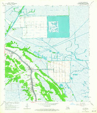
1963 Map of Cut Off
USGS Topo · Published 1964About this map
Bayou Lafourche serves as the central artery for this mid-century Louisiana landscape, with the settlements of Larose and Cut Off lining its banks. The map reveals an intricate balance between the natural wetlands and industrial progress, defined by the expansion of the Intracoastal Waterway and large-scale agricultural operations like Delta Farms and Clovelly Farms. Beyond the residential strips, the terrain is shaped by energy extraction, featuring the Bayou Poignard Gas Field and the Cut Off Oil and Gas Field.
Find a feature on this map
31 named features on this map. Tap any name to fly to it.
Don’t see what you’re looking for? This feature index may not catch every label — zoom into the map to look around manually.
Map Details
Editions of this 1963 Cut Off Map
4 editions found

Other maps of this area

1892 · Barataria
USGS Topo · 1:62,500

1892 · Cut-Off
USGS Topo · 1:62,500

1892 · Creole
USGS Topo · 1:62,500

1894 · Lake Felicity
USGS Topo · 1:62,500

1935 · Viguerie Canal
USGS Topo · 1:31,680

1935 · Golden Meadow
USGS Topo · 1:31,680

1939 · Cut-Off
USGS Topo · 1:62,500

1939 · Lake Felicity
USGS Topo · 1:62,500

1941 · Cut-Off
USGS Topo · 1:62,500

1941 · Lake Felicity
USGS Topo · 1:62,500