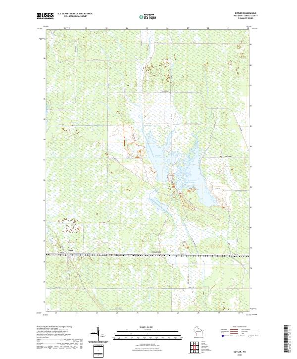
2022 Map of Cutler
USGS Topo · Published 2022About this map
The Little Yellow River winds through the wetlands of central Juneau County, defining a landscape shaped by intricate water management systems. The hydrology of this region is heavily modified by a network of engineered waterways, including the Avery Lateral, Bewick Lateral, and the Spencer-Robinson Ditch, which channel water across the low-lying terrain. The settlement of Cutler sits in the southwest, while Cloverdale provides a focal point further east. Central to the area’s character is the Rynearson Flowage 1 and Number Two Pool, where recreation and conservation converge. A network of specialized paths like the Boghaunter Trl, Pond Trl, and Visitor Center Trl suggests a managed natural area, complemented by an Observation Tower that overlooks the expansive marshes. The grid of rural roads, such as Speedway RD and Coaver RD, connects these scattered settlements and drainage features within the township boundaries.
Find a feature on this map
37 named features on this map. Tap any name to fly to it.
Don’t see what you’re looking for? This feature index may not catch every label — zoom into the map to look around manually.
Map Details
Editions of this 2022 Cutler Map
This is the sole edition of this map. No revisions or reprints were ever made.
Other maps of this area

1919 · Kendall
USGS Topo · 1:62,500

1921 · Mauston
USGS Topo · 1:62,500

1921 · Kendall
USGS Topo · 1:62,500

1953 · Eau Claire
USGS Topo · 1:250,000

1958 · Eau Claire
USGS Topo · 1:250,000

1958 · Necedah
USGS Topo · 1:48,000

1958 · Wyeville
USGS Topo · 1:48,000

1958 · La Crosse
USGS Topo · 1:250,000

1961 · La Crosse
USGS Topo · 1:250,000

1962 · Kendall
USGS Topo · 1:62,500