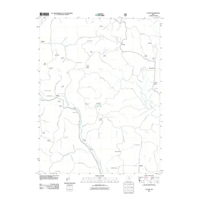
2011 Map of Cutler
USGS Topo · Published 2011About this map
The Hocking River meanders through the southern portion of this Washington County landscape, anchoring a network of hollows and ridges that defined early settlement. The small communities of Frost, Beebe, and Cutler serve as local hubs, connected by a dense web of township and county roads like Linton Hill Rd and Goddard Rd. The geography is characterized by frequent smaller waterways including Gilbert Run and Laurel Run, which feed into the larger river system and influence the placement of historic farmsteads.
Find a feature on this map
110 named features on this map. Tap any name to fly to it.
Don’t see what you’re looking for? This feature index may not catch every label — zoom into the map to look around manually.
Map Details
Editions of this 2011 Cutler Map
This is the sole edition of this map. No revisions or reprints were ever made.
Other maps of this area

1902 · Parkersburg
USGS Topo · 1:62,500

1904 · Parkersburg
USGS Topo · 1:62,500

1904 · Chesterhill
USGS Topo · 1:62,500

1906 · Belleville
USGS Topo · 1:62,500

1906 · Chesterhill
USGS Topo · 1:62,500

1907 · Keno
USGS Topo · 1:62,500

1924 · Belleville
USGS Topo · 1:62,500

1926 · Belleville
USGS Topo · 1:62,500

1949 · Clarksburg
USGS Topo · 1:250,000

1956 · Clarksburg
USGS Topo · 1:250,000