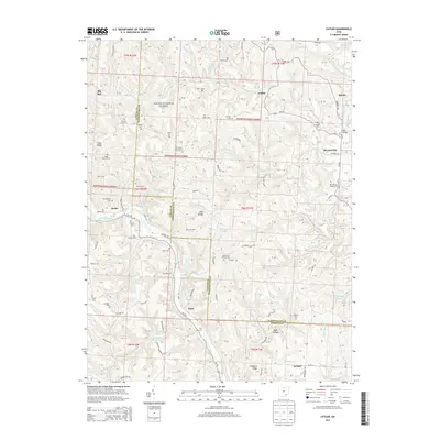
2013 Map of Cutler
USGS Topo · Published 2013About this map
Wayne National Forest land dominates this section of southeastern Ohio, where deep hollows and narrow ridges separate small communities like Cutler and Frost. The landscape is a network of rural roads and family-named landmarks, many of which are documented through an exceptional density of small burial grounds. Genealogists will find names such as Timothy Jones Cem, Boyles Cem, and Jarvis Cem tucked into the wooded slopes. The terrain is defined by the Hocking River and the W Br Little Hocking River, which carve through the plateau. Significant natural and man-made landmarks, including the Rock Bridge geological feature and the Root Bridge crossing, anchor the local geography. Scattered settlements like Decaturville and Beebe remain connected by historical routes like Oh-555, illustrating the enduring layout of these rural townships in the early 21st century.
Find a feature on this map
101 named features on this map. Tap any name to fly to it.
Don’t see what you’re looking for? This feature index may not catch every label — zoom into the map to look around manually.
Map Details
Editions of this 2013 Cutler Map
This is the sole edition of this map. No revisions or reprints were ever made.
Other maps of this area

1902 · Parkersburg
USGS Topo · 1:62,500

1904 · Parkersburg
USGS Topo · 1:62,500

1904 · Chesterhill
USGS Topo · 1:62,500

1906 · Belleville
USGS Topo · 1:62,500

1906 · Chesterhill
USGS Topo · 1:62,500

1907 · Keno
USGS Topo · 1:62,500

1924 · Belleville
USGS Topo · 1:62,500

1926 · Belleville
USGS Topo · 1:62,500

1949 · Clarksburg
USGS Topo · 1:250,000

1956 · Clarksburg
USGS Topo · 1:250,000