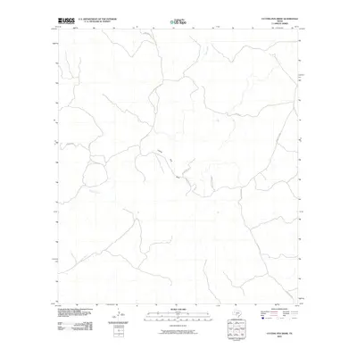
2010 Map of Cutting Pen Draw
USGS Topo · Published 2010About this map
Cutting Pen Draw winds through this sparsely settled pocket of the Texas Hill Country, defining the drainage patterns of a landscape dominated by ranching and intermittent seasonal streams. The terrain is largely shaped by the winding courses of Indian Creek and Kickapoo Creek, which carve through the Edwards Plateau. Transportation in the early twenty-first century remains focused on a network of unpaved roads and ranch access routes, most notably Cedar Creek Rd and Robinson Rd. The prominence of named private infrastructure like Voger Ranch Rd and Carroll Ranch Rd indicates the persistent large-acreage landholding patterns typical of this region. This survey captures the area before modern development, showing a territory where the natural topography of draws and creeks still dictates the placement of every road and boundary.
Find a feature on this map
9 named features on this map. Tap any name to fly to it.
Don’t see what you’re looking for? This feature index may not catch every label — zoom into the map to look around manually.
Map Details
Editions of this 2010 Cutting Pen Draw Map
This is the sole edition of this map. No revisions or reprints were ever made.
Other maps of this area

1893 · Nueces
USGS Topo · 1:125,000

1896 · Nueces
USGS Topo · 1:125,000

1944 · Barksdale
USGS Topo · 1:62,500

1944 · Indian Creek
USGS Topo · 1:62,500

1944 · Indian Mountain
USGS Topo · 1:62,500

1947 · Hackberry
USGS Topo · 1:62,500

1958 · Del Rio
USGS Topo · 1:250,000

1964 · Del Rio
USGS Topo · 1:250,000
1967 · Indian Mountain
USGS Topo · 1:24,000
1971 · Cub Lake
USGS Topo · 1:24,000