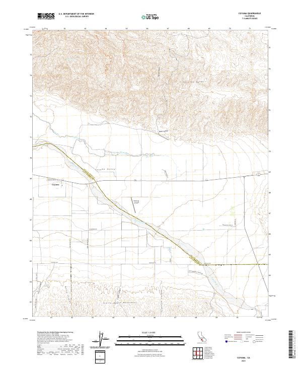
2021 Map of Cuyama
USGS Topo · Published 2021About this map
The Cuyama Valley defines this portion of the California landscape, serving as a broad agricultural and transport corridor between the towering Caliente Range to the north and the Sierra Madre Mountains to the south. This 2021 survey shows the settlement of Cuyama situated along Highway 166, adjacent to the braided channels of the Cuyama River and the ephemeral drainage known as The Wash. The region's aviation and agricultural history is evident in the presence of Vosburgh Airfield and a systematic grid of rural routes like Foothill Rd and Kirschenmann Rd. The map documents the complex topography of the surrounding high country, including Quail Canyon and Olive Canyon, where numerous seasonal springs such as Willow Spring dot the arid terrain.
Find a feature on this map
33 named features on this map. Tap any name to fly to it.
Don’t see what you’re looking for? This feature index may not catch every label — zoom into the map to look around manually.
Map Details
Editions of this 2021 Cuyama Map
This is the sole edition of this map. No revisions or reprints were ever made.
Other maps of this area

1902 · Santa Ynez
USGS Topo · 1:125,000

1903 · Mt. Pinos
USGS Topo · 1:125,000

1905 · Santa Ynez
USGS Topo · 1:125,000

1910 · Buena Vista Lake
USGS Topo · 1:125,000

1912 · McKittrick
USGS Topo · 1:125,000

1912 · Buena Vista Lake
USGS Topo · 1:125,000

1942 · Ballinger Canyon
USGS Topo · 1:24,000

1942 · East of Cuyama Ranch
USGS Topo · 1:24,000

1943 · Maricopa
USGS Topo · 1:31,680

1943 · Cuyama Ranch
USGS Topo · 1:31,680