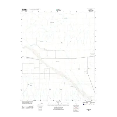
2012 Map of Cuyama
USGS Topo · Published 2012About this map
Cuyama stands as the primary human settlement in this high-desert valley, situated where the arid plains meet the rising slopes of the Caliente Range. The layout of the town is defined by a grid of residential and agricultural service streets, reflecting the community’s role as an outpost for local ranching and the regional oil industry. The landscape is dominated by the broad, braided wash of the Cuyama River, which cuts a wide path through the valley floor, creating a stark contrast between the seasonal riverbed and the surrounding dry terrain. Away from the town center, the map reveals a network of roads and canyons, such as Goode Canyon and Castro Canyon, that lead into the rugged foothills, illustrating how human development is concentrated in the lowlands while the steeper elevations remain largely open land.
Find a feature on this map
1 named feature on this map. Tap any name to fly to it.
Don’t see what you’re looking for? This feature index may not catch every label — zoom into the map to look around manually.
Map Details
Editions of this 2012 Cuyama Map
This is the sole edition of this map. No revisions or reprints were ever made.
Other maps of this area

1902 · Santa Ynez
USGS Topo · 1:125,000

1903 · Mt. Pinos
USGS Topo · 1:125,000

1905 · Santa Ynez
USGS Topo · 1:125,000

1910 · Buena Vista Lake
USGS Topo · 1:125,000

1912 · McKittrick
USGS Topo · 1:125,000

1912 · Buena Vista Lake
USGS Topo · 1:125,000

1942 · Ballinger Canyon
USGS Topo · 1:24,000

1942 · East of Cuyama Ranch
USGS Topo · 1:24,000

1943 · Maricopa
USGS Topo · 1:31,680

1943 · Cuyama Ranch
USGS Topo · 1:31,680