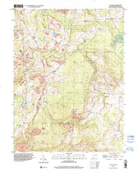
1997 Map of Cuzzart
USGS Topo · Published 2002About this map
Pleasant Mountains dominate the landscape of the Portland District, where this late-century topography reveals a rural West Virginia terrain heavily shaped by extractive industry. Numerous sites of Strip Mine and Former Mine operations are scattered across the ridges, particularly around the headwaters of Beaver Creek and Glade Run. These industrial scars contrast with the established network of country life, characterized by a high density of rural schoolhouses and churches that served small crossroads communities.
Find a feature on this map
41 named features on this map. Tap any name to fly to it.
Don’t see what you’re looking for? This feature index may not catch every label — zoom into the map to look around manually.
Map Details
Editions of this 1997 Cuzzart Map
This is the sole edition of this map. No revisions or reprints were ever made.
Other maps of this area

1886 · St. George
USGS Topo · 1:125,000

1891 · St. George
USGS Topo · 1:125,000

1895 · Piedmont
USGS Topo · 1:125,000

1899 · Oakland
USGS Topo · 1:62,500

1900 · Accident
USGS Topo · 1:62,500

1900 · Oakland
USGS Topo · 1:62,500

1904 · Bruceton
USGS Topo · 1:62,500

1907 · Kingwood
USGS Topo · 1:62,500

1925 · Kingwood
USGS Topo · 1:62,500

1926 · Bruceton
USGS Topo · 1:62,500