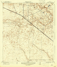
1918 Map of Cypress
USGS Topo · Published 1942About this map
Cypress serves as the primary hub of this Harris County prairie landscape during the early twentieth century. The settlement sits at a strategic junction where the Houston and Hempstead Central Road cuts diagonally across the terrain, paralleling the rail line and linking the Gulf Coast to the interior. This survey, conducted just before the United States entered the Great War, reveals a rural economy organized around seasonal waterways and ranching outposts like Bains Ranch.
Find a feature on this map
14 named features on this map. Tap any name to fly to it.
Don’t see what you’re looking for? This feature index may not catch every label — zoom into the map to look around manually.
Map Details
Editions of this 1918 Cypress Map
2 editions found
Other maps of this area

1915 · Cypress
USGS Topo · 1:24,000

1915 · Katy
USGS Topo · 1:24,000

1915 · Addicks
USGS Topo · 1:24,000

1915 · Hillendahl
USGS Topo · 1:24,000

1916 · Rose Hill
USGS Topo · 1:24,000

1916 · Louetta
USGS Topo · 1:24,000

1916 · Hockley
USGS Topo · 1:24,000

1916 · Satsuma
USGS Topo · 1:24,000

1916 · Swanson
USGS Topo · 1:24,000

1918 · Cypress
USGS Topo · 1:31,680