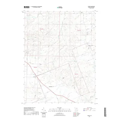
2017 Map of Cyrene
USGS Topo · Published 2017About this map
Cyrene and Edgewood anchor the southern portion of this landscape, where the terrain begins to rise toward the prominent Buffalo Knob. The area is defined by a dense network of small watercourses, including the headwaters of Buffalo Creek, Ramsey Creek, and Sandy Creek, which carve through the Pike County countryside. Further north, the small settlements of Stark and Calumet are situated near the source of Little Calumet Creek. Local genealogists and historians will find a significant number of family-named burial sites scattered throughout the quadrangle, such as Stark Cemetery, Dover Cemetery, and the Hickerson Cemetery. The map documents a rural landscape dominated by county and state routes like Highway N and Highway NN, connecting these long-standing communities and their associated landmarks like Wilson Lake and Wertz Lake.
Find a feature on this map
72 named features on this map. Tap any name to fly to it.
Don’t see what you’re looking for? This feature index may not catch every label — zoom into the map to look around manually.
Map Details
Editions of this 2017 Cyrene Map
This is the sole edition of this map. No revisions or reprints were ever made.
Other maps of this area

1890 · Louisiana
USGS Topo · 1:125,000

1930 · Nebo
USGS Topo · 1:62,500

1934 · Nebo
USGS Topo · 1:48,000

1934 · Elsberry
USGS Topo · 1:48,000

1937 · Silex
USGS Topo · 1:62,500

1937 · Bowling Green
USGS Topo · 1:62,500

1939 · Silex
USGS Topo · 1:48,000

1940 · Bowling Green
USGS Topo · 1:62,500

1942 · Nebo
USGS Topo · 1:62,500

1942 · Elsberry
USGS Topo · 1:62,500