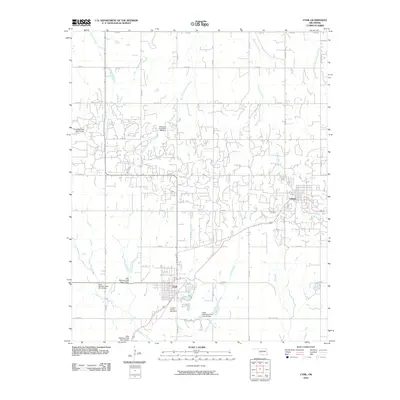
2010 Map of Cyril
USGS Topo · Published 2010About this map
Cyril and Cement anchor this landscape in Caddo County, where the plains of Oklahoma are defined by a sophisticated water management network. In the late 20th century, numerous flood control structures were established along the tributaries of the Little Washita River and Delaware Creek. These are identified on the map as specific sites, including Little Washita Creek Site 26 Dam and Tonkawa Creek Site 1a Dam. The town of Cyril displays a dense residential grid just south of a bend in the river, while Cement sits to the east, connected by a highway corridor that follows the terrain of McCarty Creek. Local history is preserved in sites like the Celestial Gardens Cemetery and the Cement Cemetery, which serve as vital landmarks for genealogists tracing families in this part of the state.
Find a feature on this map
35 named features on this map. Tap any name to fly to it.
Don’t see what you’re looking for? This feature index may not catch every label — zoom into the map to look around manually.
Map Details
Editions of this 2010 Cyril Map
This is the sole edition of this map. No revisions or reprints were ever made.
Other maps of this area

1945 · Anadarko
USGS Topo · 1:62,500

1949 · Cement
USGS Topo · 1:62,500

1949 · Elgin
USGS Topo · 1:24,000

1951 · Fort Cobb
USGS Topo · 1:62,500

1955 · Lawton
USGS Topo · 1:250,000

1955 · Clinton
USGS Topo · 1:250,000

1956 · Laverty
USGS Topo · 1:24,000

1956 · Fletcher
USGS Topo · 1:24,000
1956 · Rocky Ford
USGS Topo · 1:24,000

1956 · Elgin
USGS Topo · 1:24,000