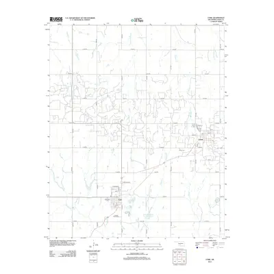
2012 Map of Cyril
USGS Topo · Published 2012About this map
Cyril and Cement anchor this part of Caddo County, situated within a landscape defined by an intricate network of sectional roads and the headwaters of several southern Oklahoma waterways. The map illustrates a grid-like development pattern where residential streets such as Wyoming Ave and Marie Ave meet the rural reaches of Pritchard Dr. Local history and genealogy are preserved in the locations of Celestial Gardens Cem and Cement Cem, which serve as vital landmarks for tracing the families that settled this area.
Find a feature on this map
39 named features on this map. Tap any name to fly to it.
Don’t see what you’re looking for? This feature index may not catch every label — zoom into the map to look around manually.
Map Details
Editions of this 2012 Cyril Map
This is the sole edition of this map. No revisions or reprints were ever made.
Other maps of this area

1945 · Anadarko
USGS Topo · 1:62,500

1949 · Cement
USGS Topo · 1:62,500

1949 · Elgin
USGS Topo · 1:24,000

1951 · Fort Cobb
USGS Topo · 1:62,500

1955 · Lawton
USGS Topo · 1:250,000

1955 · Clinton
USGS Topo · 1:250,000

1956 · Laverty
USGS Topo · 1:24,000

1956 · Fletcher
USGS Topo · 1:24,000
1956 · Rocky Ford
USGS Topo · 1:24,000

1956 · Elgin
USGS Topo · 1:24,000