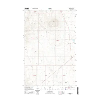
2014 Map of D Y Junction
USGS Topo · Published 2014About this map
DY Junction serves as the focal point for this section of Phillips County, where Us-191 and MT-66 meet in the wide-open Montana landscape. The terrain is defined by dramatic elevation changes, most notably at Thornhill Butte, which towers over the surrounding drainages of Siparyann Cr and Mud Cr. The map captures a landscape shaped by both natural erosion and human management, evidenced by the numerous coulees such as Coyote Coulee and Hay Coulee that carve through the plains.
Find a feature on this map
24 named features on this map. Tap any name to fly to it.
Don’t see what you’re looking for? This feature index may not catch every label — zoom into the map to look around manually.
Map Details
Editions of this 2014 D Y Junction Map
This is the sole edition of this map. No revisions or reprints were ever made.
Other maps of this area

1943 · Landusky
USGS Topo · 1:125,000

1954 · Bell Ridge East
USGS Topo · 1:24,000

1954 · Bell Ridge West
USGS Topo · 1:24,000

1954 · Grand Island
USGS Topo · 1:24,000

1954 · Lewistown
USGS Topo · 1:250,000

1959 · Lewistown
USGS Topo · 1:250,000

1971 · Crazyman Coulee
USGS Topo · 1:24,000

1971 · Hays
USGS Topo · 1:24,000

1971 · Hays SE
USGS Topo · 1:24,000
1971 · Zortman
USGS Topo · 1:24,000