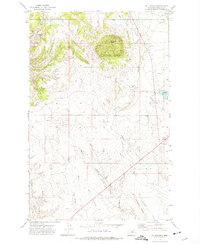
1971 Map of D Y Junction
USGS Topo · Published 1975About this map
Thornhill Butte commands the northern landscape of this Phillips County region, rising above a network of drainages that define the high plains of north-central Montana. In the early 1970s, the road network centered on DY Junction, where highway 191 intersects with local routes near the southeastern portion of the map. This area is characterized by significant topographic features such as Bell Ridge and Siparyann Ridge, which separate the various coulees and creek beds that channel seasonal runoff.
Find a feature on this map
18 named features on this map. Tap any name to fly to it.
Don’t see what you’re looking for? This feature index may not catch every label — zoom into the map to look around manually.
Map Details
Editions of this 1971 D Y Junction Map
This is the sole edition of this map. No revisions or reprints were ever made.
Other maps of this area

1943 · Landusky
USGS Topo · 1:125,000

1954 · Bell Ridge East
USGS Topo · 1:24,000

1954 · Bell Ridge West
USGS Topo · 1:24,000

1954 · Grand Island
USGS Topo · 1:24,000

1954 · Lewistown
USGS Topo · 1:250,000

1959 · Lewistown
USGS Topo · 1:250,000

1971 · Crazyman Coulee
USGS Topo · 1:24,000

1971 · Hays
USGS Topo · 1:24,000

1971 · Hays SE
USGS Topo · 1:24,000
1971 · Zortman
USGS Topo · 1:24,000