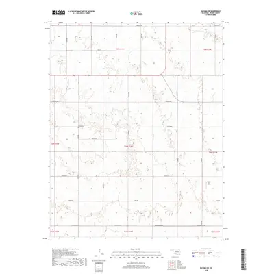
2018 Map of Dacoma SW
USGS Topo · Published 2018About this map
Highland Cem stands as a focal point of local heritage in this section of Woods County, situated amidst a grid of rural section-line roads. The landscape is defined by the ephemeral drainage of Sand Cr in the north and a dense network of county routes including Comanche Rd, Cimarron Rd, and the Aline Blacktop Rd. This 2018 survey illustrates the persistent agricultural organization of the Oklahoma plains, where the land is partitioned into precise townships such as t24n r14w. A notable modern addition to this rural environment is the Logsdon Ranch Airport, reflecting the intersection of traditional ranching and private aviation in the modern era. The naming of roads like Choctaw Rd and Canadian Rd suggests a landscape tied to regional geography and history, even as the terrain remains primarily dedicated to open-country uses.
Find a feature on this map
29 named features on this map. Tap any name to fly to it.
Don’t see what you’re looking for? This feature index may not catch every label — zoom into the map to look around manually.
Map Details
Editions of this 2018 Dacoma SW Map
This is the sole edition of this map. No revisions or reprints were ever made.
Other maps of this area

1955 · Woodward
USGS Topo · 1:250,000

1958 · Woodward
USGS Topo · 1:250,000

1969 · Dacoma
USGS Topo · 1:24,000

1969 · Dacoma SW
USGS Topo · 1:24,000

1969 · Glass Mountains NW
USGS Topo · 1:24,000

1969 · Hopeton
USGS Topo · 1:24,000

1969 · Avard
USGS Topo · 1:24,000

1969 · Waynoka East
USGS Topo · 1:24,000

1969 · Glass Mountains NE
USGS Topo · 1:24,000

1969 · Togo
USGS Topo · 1:24,000