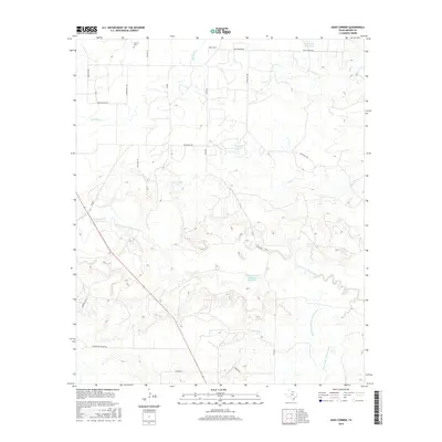
2016 Map of Dads Corner
USGS Topo · Published 2016About this map
The Stewart Cem stands as a quiet genealogical anchor in this rural portion of Archer County, situated near the northern border of the survey. The landscape is defined by the convergence of several major water systems, including the N Fork Little Wichita River, the Middle Fork Little Wichita River, and the S Fork Little Wichita River. These waterways, along with tributaries like Panther Cr and Bluff Cr, illustrate the complex drainage patterns of the region. The map reveals an industrial overlay of energy and water management, evidenced by the Continental Oil Company Reservoir, the Oil Investment Company Reservoir, and specialized features like the Cole Storage Tank and Windmill Tank. A network of ranch roads, such as Coppermine Ranch Rd and Parish Ranch Rd, connects these remote sites.
Find a feature on this map
26 named features on this map. Tap any name to fly to it.
Don’t see what you’re looking for? This feature index may not catch every label — zoom into the map to look around manually.
Map Details
Editions of this 2016 Dads Corner Map
This is the sole edition of this map. No revisions or reprints were ever made.
Other maps of this area

1931 · Archer City
USGS Topo · 1:62,500

1932 · Dundee
USGS Topo · 1:62,500

1954 · Wichita Falls
USGS Topo · 1:250,000

1956 · Lake Wichita
USGS Topo · 1:24,000

1957 · Wichita Falls West
USGS Topo · 1:62,500

1958 · Wichita Falls
USGS Topo · 1:250,000
1963 · Archer City NE
USGS Topo · 1:24,000

1963 · Archer City East
USGS Topo · 1:24,000

1964 · Dundee SE
USGS Topo · 1:24,000

1964 · Archer City West
USGS Topo · 1:24,000