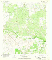
1966 Map of Dads Corner
USGS Topo · Published 1968About this map
The North Texas plains of Archer County are defined by industrial development and a network of waterways in the mid-1960s. At the center of this landscape is Dads Corner, a small crossroads surrounded by an extensive Oil Field. This area is characterized by a dense grid of infrastructure, including a prominent Aqueduct and multiple Pipeline routes that crisscross the terrain to support the region's energy production. To the northwest, the Stewart Cem offers a grounded connection for genealogists researching early settlers in this rural Texas district.
Find a feature on this map
16 named features on this map. Tap any name to fly to it.
Don’t see what you’re looking for? This feature index may not catch every label — zoom into the map to look around manually.
Map Details
Editions of this 1966 Dads Corner Map
This is the sole edition of this map. No revisions or reprints were ever made.
Other maps of this area

1931 · Archer City
USGS Topo · 1:62,500

1932 · Dundee
USGS Topo · 1:62,500

1954 · Wichita Falls
USGS Topo · 1:250,000

1956 · Lake Wichita
USGS Topo · 1:24,000

1957 · Wichita Falls West
USGS Topo · 1:62,500

1958 · Wichita Falls
USGS Topo · 1:250,000
1963 · Archer City NE
USGS Topo · 1:24,000

1963 · Archer City East
USGS Topo · 1:24,000

1964 · Dundee SE
USGS Topo · 1:24,000

1964 · Archer City West
USGS Topo · 1:24,000