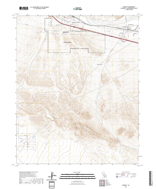
2021 Map of Daggett
USGS Topo · Published 2021About this map
The Mojave River corridor in San Bernardino County defines the landscape of this 2021 study, where the high desert meets the structured grid of regional transport. The settlement of Daggett occupies a strategic position south of the river, anchored by its proximity to the Mojave Valley and the historic National Trails Hwy. To the east, the Daggett Pioneer Cem serves as a quiet record of the area's early residents, while the surrounding terrain rises toward the prominent Daggett Ridge and Daggett Wash. The presence of residential streets named for Pacific theater battles, such as Kwajalein St, Iwo Jima St, and Tarawa Ave, reflects the enduring influence of military logistics and infrastructure near the Barstow outskirts. This intersection of natural desert drainage and modern surface roads reveals how the arid environment has been navigated and mapped into the twenty-first century.
Find a feature on this map
39 named features on this map. Tap any name to fly to it.
Don’t see what you’re looking for? This feature index may not catch every label — zoom into the map to look around manually.
Map Details
Editions of this 2021 Daggett Map
This is the sole edition of this map. No revisions or reprints were ever made.
Other maps of this area

1932 · Barstow
USGS Topo · 1:125,000

1934 · Barstow
USGS Topo · 1:125,000

1953 · San Bernardino
USGS Topo · 1:250,000

1953 · Yermo
USGS Topo · 1:24,000
1953 · Nebo
USGS Topo · 1:24,000

1955 · Ord Mountains
USGS Topo · 1:62,500

1956 · San Bernardino
USGS Topo · 1:250,000

1956 · Daggett
USGS Topo · 1:62,500

1956 · Barstow
USGS Topo · 1:62,500

1957 · Apple Valley
USGS Topo · 1:62,500