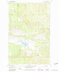
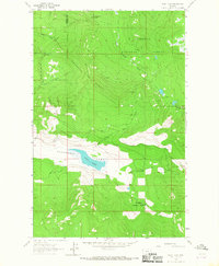
1964 Map of Dahl Lake
USGS Topo · Published 1984About this map
Dahl Lake sits at the heart of Pleasant Valley, a long topographic depression cutting through the heavily timbered lands of northwest Montana. This 1964 survey, updated through the early 1980s, captures the boundary between the Kootenai National Forest and the Flathead National Forest, where the border between Lincoln and Flathead Counties follows the high ridges. The landscape is defined by its drainages, including Coniff Creek and Meadows Creek, which flow toward the central valley basin.
Find a feature on this map
14 named features on this map. Tap any name to fly to it.
Don’t see what you’re looking for? This feature index may not catch every label — zoom into the map to look around manually.
Map Details
Editions of this 1964 Dahl Lake Map
2 editions found
Other maps of this area

1957 · Kalispell
USGS Topo · 1:250,000

1960 · Kalispell
USGS Topo · 1:250,000

1961 · Kalispell
USGS Topo · 1:250,000

1962 · Ashley Mountain
USGS Topo · 1:24,000

1963 · Sylvia Lake
USGS Topo · 1:24,000
1963 · Horse Hill
USGS Topo · 1:24,000

1964 · Meadow Peak
USGS Topo · 1:24,000
1964 · Pleasant Valley Mountain
USGS Topo · 1:24,000
1964 · Marion
USGS Topo · 1:24,000
1964 · Dahl Lake
USGS Topo · 1:24,000