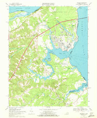
1968 Map of Dahlgren
USGS Topo · Published 1972About this map
U S Naval Reservation Dahlgren Weapons Laboratory dominates the riverfront landscape where the Potomac River meets the tidal inlets of Machodoc Creek. This 1968 field-checked survey reveals a specialized military-industrial geography, featuring the U S Government Railroad, a Golf Course, and a Marina serving the base personnel. Beyond the laboratory gates, the terrain transitions into a mosaic of rural settlements and agricultural family lands.
Find a feature on this map
58 named features on this map. Tap any name to fly to it.
Don’t see what you’re looking for? This feature index may not catch every label — zoom into the map to look around manually.
Map Details
Editions of this 1968 Dahlgren Map
2 editions found
Other maps of this area

1889 · Fredericksburg
USGS Topo · 1:125,000

1892 · Fredericksburg
USGS Topo · 1:125,000

1892 · Montross
USGS Topo · 1:62,500

1894 · Wicomico
USGS Topo · 1:62,500

1894 · Fredericksburg
USGS Topo · 1:125,000

1895 · Wicomico
USGS Topo · 1:62,500

1895 · Nomini
USGS Topo · 1:125,000

1895 · Montross
USGS Topo · 1:62,500

1898 · Nomini
USGS Topo · 1:125,000

1902 · Wicomico
USGS Topo · 1:62,500