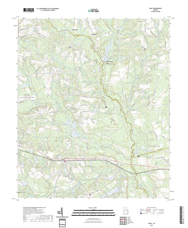
2024 Map of Daisy
USGS Topo · Published 2024About this map
Daisy serves as the primary settlement on this landscape, positioned along the Georgia Central Railway corridor near the borders of Evans, Bulloch, and Bryan counties. The area is characterized by a series of family-named ponds and mills, such as Bowen Mill and Anderson Mill, which speak to a historical reliance on the local waterways for industry and community hubs. Significant landholdings, including those of the Saint Regis Paper Company, are interspersed among small rural settlements like Edna and Overbrook.
Find a feature on this map
134 named features on this map. Tap any name to fly to it.
Don’t see what you’re looking for? This feature index may not catch every label — zoom into the map to look around manually.
Map Details
Editions of this 2024 Daisy Map
This is the sole edition of this map. No revisions or reprints were ever made.
Other maps of this area

1919 · Claxton
USGS Topo · 1:62,500

1920 · Pembroke
USGS Topo · 1:62,500

1920 · Statesboro
USGS Topo · 1:62,500

1921 · Brooklet
USGS Topo · 1:62,500

1943 · Brooklet
USGS Topo · 1:62,500

1943 · Statesboro
USGS Topo · 1:62,500

1944 · Claxton
USGS Topo · 1:62,500

1947 · Savannah
USGS Topo · 1:250,000

1948 · Savannah
USGS Topo · 1:250,000

1948 · Pembroke
USGS Topo · 1:62,500