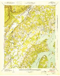
1943 Map of Daisy
USGS Topo · Published 1943About this map
Chickamauga Reservoir dominates the eastern landscape of this 1943 survey, where the recently flooded valley of the Tennessee River reshaped the shoreline near Daisy and Hixson. The map documents a transition from traditional river-bottom agriculture to a recreation-centered economy, evidenced by the Harrison State Park reservation and the Chattanooga Rod and Gun Club. Industrial traces like the kilns in Daisy and the Upper Mill and Lower Mill on Falling Water Cr sit alongside established community anchors such as Jackson Chapel and Middle Valley Sch. The Southern Railway runs parallel to the Dayton Highway, providing the backbone for settlements like Melville and Montlake at the foot of Walden Ridge. Family history researchers can locate numerous burial grounds, including the Maddox Cem and Davidson Cem, as well as the Harrison Bluff Cabin Site Area.
Find a feature on this map
70 named features on this map. Tap any name to fly to it.
Don’t see what you’re looking for? This feature index may not catch every label — zoom into the map to look around manually.
Map Details
Editions of this 1943 Daisy Map
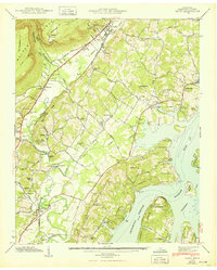
2 editions found
Other maps of this area

1888 · Chattanooga
USGS Topo · 1:125,000

1893 · Chattanooga
USGS Topo · 1:125,000

1935 · East Chattanooga
USGS Topo · 1:24,000

1935 · Daisy
USGS Topo · 1:24,000

1935 · Soddy
USGS Topo · 1:24,000

1935 · Snow Hill
USGS Topo · 1:24,000

1935 · Ooltewah
USGS Topo · 1:24,000

1935 · Soddy Island
USGS Topo · 1:24,000

1936 · Henson Gap
USGS Topo · 1:24,000

1936 · Fairmount
USGS Topo · 1:24,000