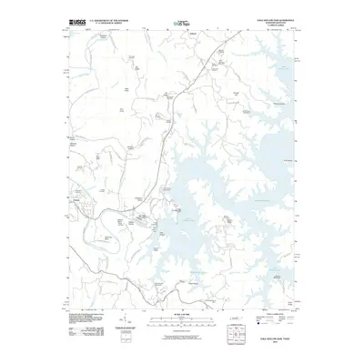
2010 Map of Dale Hollow Dam
USGS Topo · Published 2010About this map
The Obey River and Cumberland River confluence at Celina anchor this landscape, where modern hydroelectric infrastructure meets deep-seated rural roots. The massive impoundment of Dale Hollow Lake dominates the topography, created by the engineering of the Dale Hollow Dam and supported by facilities like the Dale Hollow Fish Hatchery. Away from the water, the terrain is a complex network of ridges and hollows, including Canoe Ridge and Barksdale Hollow, that have long dictated the placement of small communities and family burial grounds. Numerous legacy sites such as Thompson Cemetery, Donaldson Cemetery, and Keen Cemetery are scattered across the uplands, offering significant data points for genealogical research in this portion of Clay County. The presence of the Standing Stone Dam further illustrates the era's focus on water management and regional development.
Find a feature on this map
100 named features on this map. Tap any name to fly to it.
Don’t see what you’re looking for? This feature index may not catch every label — zoom into the map to look around manually.
Map Details
Editions of this 2010 Dale Hollow Dam Map
This is the sole edition of this map. No revisions or reprints were ever made.
Other maps of this area

1897 · Standingstone
USGS Topo · 1:125,000

1898 · Standingstone
USGS Topo · 1:125,000

1924 · Lillydale
USGS Topo · 1:62,500

1925 · Gainesboro
USGS Topo · 1:62,500

1926 · Lillydale
USGS Topo · 1:62,500

1929 · Lillydale
USGS Topo · 1:62,500

1929 · Gainesboro
USGS Topo · 1:62,500

1929 · Tompkinsville
USGS Topo · 1:62,500

1944 · Livingston
USGS Topo · 1:24,000

1954 · Frogue
USGS Topo · 1:24,000