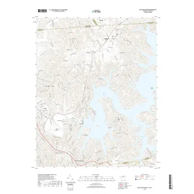
2019 Map of Dale Hollow Dam
USGS Topo · Published 2019About this map
The Obey River and the complex shoreline of Dale Hollow Lake dominate this 2019 survey, illustrating the modern landscape of the Tennessee and Kentucky border. The topography is defined by the massive Dale Hollow Dam, which regulates the waters surrounding Canoe Ridge and Swann Ridge. For the local historian or genealogist, the map is remarkably detailed in its identification of rural family burial grounds, including the Thompson Cem, Rock Springs Cem, and Donaldson Cem.
Find a feature on this map
134 named features on this map. Tap any name to fly to it.
Don’t see what you’re looking for? This feature index may not catch every label — zoom into the map to look around manually.
Map Details
Editions of this 2019 Dale Hollow Dam Map
This is the sole edition of this map. No revisions or reprints were ever made.
Other maps of this area

1897 · Standingstone
USGS Topo · 1:125,000

1898 · Standingstone
USGS Topo · 1:125,000

1924 · Lillydale
USGS Topo · 1:62,500

1925 · Gainesboro
USGS Topo · 1:62,500

1926 · Lillydale
USGS Topo · 1:62,500

1929 · Lillydale
USGS Topo · 1:62,500

1929 · Gainesboro
USGS Topo · 1:62,500

1929 · Tompkinsville
USGS Topo · 1:62,500

1944 · Livingston
USGS Topo · 1:24,000

1954 · Frogue
USGS Topo · 1:24,000