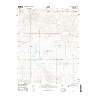
2017 Map of Dale Mountain
USGS Topo · Published 2017About this map
Saint John's Methodist Episcopal Church Cem serves as a central landmark in this high-altitude landscape where the state lines of Colorado and New Mexico meet. The terrain is defined by prominent elevations such as Johnson Mesa and Dale Mountain, while drainage networks including Una de Gato Cr and the Dry Cimarron River carve through the canyons.
Find a feature on this map
41 named features on this map. Tap any name to fly to it.
Don’t see what you’re looking for? This feature index may not catch every label — zoom into the map to look around manually.
Map Details
Editions of this 2017 Dale Mountain Map
This is the sole edition of this map. No revisions or reprints were ever made.
Other maps of this area

1892 · Elmoro
USGS Topo · 1:125,000

1893 · Elmoro
USGS Topo · 1:125,000

1897 · Elmoro
USGS Topo · 1:125,000

1912 · Raton
USGS Topo · 1:62,500

1914 · Raton
USGS Topo · 1:62,500

1954 · Raton
USGS Topo · 1:250,000

1954 · Trinidad
USGS Topo · 1:250,000

1955 · Trinidad
USGS Topo · 1:250,000

1958 · Raton
USGS Topo · 1:250,000

1958 · Trinidad
USGS Topo · 1:250,000