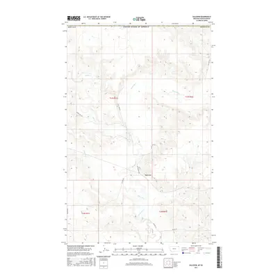
2017 Map of Daleview
USGS Topo · Published 2017About this map
Daleview sits at the heart of this Sheridan County landscape, where the confluence of prairie hydrology and early transport routes shaped local settlement. The drainage patterns of Big Muddy Cr and its tributaries, Beaver Cr and Whitetail Cr, dominate the terrain, illustrating the importance of water access in this northern border region. Roadways such as Dutch Henry Rd and Daleview Rd follow the natural contours of the land, while the presence of Soo Line Rd to the south alludes to the vital rail corridor that once linked these remote agricultural communities to larger markets. This survey captures the rural character of the area just south of the international boundary, documenting the grid-work of section lines that define the legal and physical geography of the Montana plains.
Find a feature on this map
17 named features on this map. Tap any name to fly to it.
Don’t see what you’re looking for? This feature index may not catch every label — zoom into the map to look around manually.
Map Details
Editions of this 2017 Daleview Map
This is the sole edition of this map. No revisions or reprints were ever made.
Other maps of this area

1954 · Wolf Point
USGS Topo · 1:250,000

1958 · Wolf Point
USGS Topo · 1:250,000

1973 · Navajo
USGS Topo · 1:24,000

1973 · Goodale Coulee
USGS Topo · 1:24,000
1983 · Daleview
USGS Topo · 1:24,000

1983 · Outlook
USGS Topo · 1:24,000

1983 · Redstone
USGS Topo · 1:24,000

1983 · Archer
USGS Topo · 1:24,000

1983 · Scobey
USGS Topo · 1:100,000
2011 · Archer
USGS Topo · 1:24,000