
1973 Map of Navajo
USGS Topo · Published 1976About this map
Navajo sits along the Burlington Northern line in the High Plains of northeast Montana, situated near the headwaters of the drainage network that feeds into Eagle Creek. This 1970s landscape is defined by the sharp transition between the undulating upland benches and the deeply incised coulees where the North Fork and Middle Fork meet. The terrain is marked by the prominent Eagles Nest formation, a rugged topographic feature that overlooks the convergence of these waterways. Human activity in this rural stretch of the Great Plains is evidenced by localized infrastructure like a Gravel Pit, isolated Storage Bins, and a Jeep Trail cutting across the breaks. The presence of a permanent Spring and the S Fork Whitetail in the northwest corner highlights the critical role of water sources in this dry, ranching-oriented environment.
Find a feature on this map
13 named features on this map. Tap any name to fly to it.
Don’t see what you’re looking for? This feature index may not catch every label — zoom into the map to look around manually.
Map Details
Editions of this 1973 Navajo Map
This is the sole edition of this map. No revisions or reprints were ever made.
Other maps of this area

1954 · Wolf Point
USGS Topo · 1:250,000

1958 · Wolf Point
USGS Topo · 1:250,000

1973 · Flaxville
USGS Topo · 1:24,000

1973 · Whitetail
USGS Topo · 1:24,000

1973 · Pleasant Prairie NW
USGS Topo · 1:24,000

1973 · Goodale Coulee
USGS Topo · 1:24,000

1973 · Pleasant Prairie NE
USGS Topo · 1:24,000
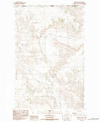
1983 · Daleview
USGS Topo · 1:24,000

1983 · Redstone
USGS Topo · 1:24,000

1983 · Soo NW
USGS Topo · 1:24,000