
1973 Map of Pleasant Prairie NE
USGS Topo · Published 1977About this map
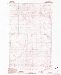
The Fort Peck Indian Reservation Boundary cuts across the southern portion of this landscape, marking a significant legal and cultural division in the rolling plains of Northeast Montana. The area is characterized by the winding courses of Eagle Creek and Wolf Creek, which have carved intricate coulees into the high prairie. Human activity is focused on agricultural infrastructure, evidenced by multiple clusters of Storage Bins used for dryland grain storage. Social and economic life in this remote stretch of the high plains is anchored by the Wolf Creek Hall, a rare named community landmark in an area otherwise defined by its vast open terrain and scattered resources. The map also documents localized industry through a Gravel Pit and several deep Well sites, reflecting the essential search for water and construction materials in this arid environment.
Find a feature on this map
9 named features on this map. Tap any name to fly to it.
Don’t see what you’re looking for? This feature index may not catch every label — zoom into the map to look around manually.
Map Details
Editions of this 1973 Pleasant Prairie NE Map
This is the sole edition of this map. No revisions or reprints were ever made.
Other maps of this area

1954 · Wolf Point
USGS Topo · 1:250,000

1958 · Wolf Point
USGS Topo · 1:250,000

1973 · Flaxville
USGS Topo · 1:24,000

1973 · Navajo
USGS Topo · 1:24,000

1973 · Pleasant Prairie
USGS Topo · 1:24,000

1973 · Pleasant Prairie NW
USGS Topo · 1:24,000

1973 · Pleasant Prairie SW
USGS Topo · 1:24,000

1983 · Redstone
USGS Topo · 1:24,000

1983 · Soo NW
USGS Topo · 1:24,000
1983 · Soo
USGS Topo · 1:24,000