
1973 Map of Pleasant Prairie
USGS Topo · Published 1976About this map
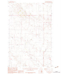
Fort Peck Indian Reservation lands define the character of this northeastern Montana landscape, where the high plains transition between Daniels and Roosevelt counties. Surveyed in the early 1970s, the map reveals a sparsely populated agricultural region centered around the small settlement of Pleasant Prairie. Social life in this corner of the prairie appears concentrated at the Pleasant Prairie Ch and its neighboring Cem, along with the Westby School Center. The winding path of Smoke Creek cuts through the northern sections, creating the primary topographic relief in an area otherwise marked by functional structures like scattered Storage Bins and a Gravel Pit. The map's detailed fencing lines and section markers suggest a landscape meticulously organized for large-scale ranching and dryland farming during this era.
Find a feature on this map
12 named features on this map. Tap any name to fly to it.
Don’t see what you’re looking for? This feature index may not catch every label — zoom into the map to look around manually.
Map Details
Editions of this 1973 Pleasant Prairie Map
This is the sole edition of this map. No revisions or reprints were ever made.
Other maps of this area

1909 · Smoke Creek
USGS Topo · 1:62,500

1912 · Hay Creek
USGS Topo · 1:62,500

1912 · Smoke Creek
USGS Topo · 1:62,500

1954 · Wolf Point
USGS Topo · 1:250,000

1958 · Wolf Point
USGS Topo · 1:250,000

1973 · Pleasant Prairie NW
USGS Topo · 1:24,000

1973 · Pleasant Prairie SW
USGS Topo · 1:24,000

1973 · Pleasant Prairie NE
USGS Topo · 1:24,000

1982 · Culbertson
USGS Topo · 1:100,000
1983 · Hay Creek NW
USGS Topo · 1:24,000
Featured Places
- Brockton District, MT
- Pleasant Prairie, Brockton District
- Roosevelt County, MT
- Daniels County, MT
- United States