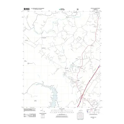
2011 Map of Daleville
USGS Topo · Published 2011About this map
Carvins Cove Reservoir dominates the southern landscape, its jagged shoreline reaching into the valley between Tinker Mountain and Brushy Mountain. This 2011 survey captures the established corridor of Botetourt County, where the historic settlement of Fincastle sits at the northern edge, connected to Daleville and Amsterdam by a network of local roads and suburban expansion. The transition from industrial or agricultural roots is evident in the numerous named mills, including Howell Mills and Glebe Mills, which line the waterways that drain toward the reservoir and Catawba Creek.
Find a feature on this map
123 named features on this map. Tap any name to fly to it.
Don’t see what you’re looking for? This feature index may not catch every label — zoom into the map to look around manually.
Map Details
Editions of this 2011 Daleville Map
This is the sole edition of this map. No revisions or reprints were ever made.
Other maps of this area

1887 · Lewisburg
USGS Topo · 1:125,000

1890 · Roanoke
USGS Topo · 1:125,000

1890 · Christiansburg
USGS Topo · 1:125,000

1891 · Roanoke
USGS Topo · 1:125,000

1891 · Lewisburg
USGS Topo · 1:125,000

1894 · Natural Bridge
USGS Topo · 1:125,000

1913 · Eagle Rock
USGS Topo · 1:48,000

1915 · Eagle Rock
USGS Topo · 1:62,500

1929 · Roanoke
USGS Topo · 1:48,000

1929 · Salem
USGS Topo · 1:48,000