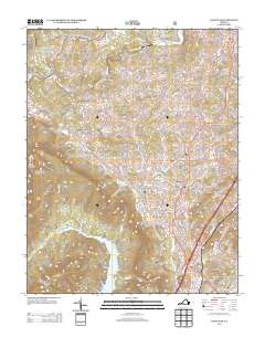
2013 Map of Daleville
USGS Topo · Published 2013About this map
Fincastle and the surrounding valleys of Botetourt County are captured here as they appeared in the early 21st century. The landscape is defined by the prominent ridge of Tinker Mountain and the southern Brushy Mountain, with the Carvin Cove Reservoir occupying the southwestern corner. The settlement pattern shows the modern growth of Daleville and Troutville along the primary road corridors, contrasting with the smaller, historically rooted communities such as Amsterdam, Haymakertown, and Glebe Mills. The presence of the Lambuts Meadow Appalachian Trail Shelter highlights the recreational value of the local ridges. Waterways like Tinker Cr, Catawba Cr, and Buffalo Cr carve through the terrain, while landmarks such as Barrows Airport and various named runs and branches illustrate the local topography and infrastructure before further suburban development.
Find a feature on this map
155 named features on this map. Tap any name to fly to it.
Don’t see what you’re looking for? This feature index may not catch every label — zoom into the map to look around manually.
Map Details
Editions of this 2013 Daleville Map
This is the sole edition of this map. No revisions or reprints were ever made.
Other maps of this area

1887 · Lewisburg
USGS Topo · 1:125,000

1890 · Roanoke
USGS Topo · 1:125,000

1890 · Christiansburg
USGS Topo · 1:125,000

1891 · Roanoke
USGS Topo · 1:125,000

1891 · Lewisburg
USGS Topo · 1:125,000

1894 · Natural Bridge
USGS Topo · 1:125,000

1913 · Eagle Rock
USGS Topo · 1:48,000

1915 · Eagle Rock
USGS Topo · 1:62,500

1929 · Roanoke
USGS Topo · 1:48,000

1929 · Salem
USGS Topo · 1:48,000