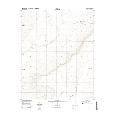
2013 Map of Dalies NW
USGS Topo · Published 2013About this map
The Rio Puerco riverbed and the Cañada los Apaches drainage define the arid landscape of this southwestern Bernalillo County region. As of 2013, the area is characterized by a network of government and tribal infrastructure, with routes such as Indian Service Route 610 and Tribal Road 611 providing the primary access through the desert terrain. The absence of named settlements or heavy industrial development highlights the rural and managed nature of the land during the early 21st century. Researchers can observe the intricate topographical details of the mesas and canyons, where even the most primitive thoroughfares, such as an Unknown Dirt Rd, are meticulously recorded. This map serves as a clear record of the intersection between natural arroyos and the established transportation corridors of the Bureau of Indian Affairs and local tribal authorities.
Find a feature on this map
8 named features on this map. Tap any name to fly to it.
Don’t see what you’re looking for? This feature index may not catch every label — zoom into the map to look around manually.
Map Details
Editions of this 2013 Dalies NW Map
This is the sole edition of this map. No revisions or reprints were ever made.
Other maps of this area

1883 · Mt. Taylor
USGS Topo · 1:250,000

1886 · Mt. Taylor
USGS Topo · 1:250,000

1888 · Bernalillo
USGS Topo · 1:125,000

1889 · Albuquerque
USGS Topo · 1:125,000

1892 · Mt. Taylor
USGS Topo · 1:250,000

1893 · Albuquerque
USGS Topo · 1:125,000

1899 · Mt. Taylor
USGS Topo · 1:250,000

1917 · Cerro Verde
USGS Topo · 1:125,000

1952 · Wind Mesa
USGS Topo · 1:24,000

1952 · Dalies
USGS Topo · 1:24,000