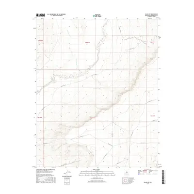
2017 Map of Dalies NW
USGS Topo · Published 2017About this map
Rio Puerco carves a distinct path through this western Bernalillo County landscape, where the ephemeral flow of Cañada los Apaches meets the main drainage. This 2017 survey by the U.S. Geological Survey illustrates a transition between the mesa country and the river valley, dominated by an extensive network of Bureau of Indian Affairs routes. The infrastructure is characterized by several designated paths such as Indian Svc Rte 611 and Indian Svc Rte 61, which navigate the varying elevations and dry washes. The map's detail focuses on the topographic relief of the mesas, revealing how ancient watercourses and modern access roads define the movement of people and resources across this high-desert environment. This documentation is essential for understanding contemporary land use and the persistence of traditional routes in the Dalies NW area.
Find a feature on this map
17 named features on this map. Tap any name to fly to it.
Don’t see what you’re looking for? This feature index may not catch every label — zoom into the map to look around manually.
Map Details
Editions of this 2017 Dalies NW Map
This is the sole edition of this map. No revisions or reprints were ever made.
Other maps of this area

1883 · Mt. Taylor
USGS Topo · 1:250,000

1886 · Mt. Taylor
USGS Topo · 1:250,000

1888 · Bernalillo
USGS Topo · 1:125,000

1889 · Albuquerque
USGS Topo · 1:125,000

1892 · Mt. Taylor
USGS Topo · 1:250,000

1893 · Albuquerque
USGS Topo · 1:125,000

1899 · Mt. Taylor
USGS Topo · 1:250,000

1917 · Cerro Verde
USGS Topo · 1:125,000

1952 · Wind Mesa
USGS Topo · 1:24,000

1952 · Dalies
USGS Topo · 1:24,000