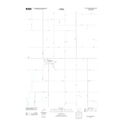
2013 Map of Dallas Center
USGS Topo · Published 2013About this map
Dallas Center City serves as the primary hub of activity in this part of Dallas County, exhibiting a classic grid of residential and commercial streets such as Sycamore St, Vine St, and Linden St. The surrounding landscape is defined by the organized section lines of Iowa's agricultural heartland, with farm-to-market roads like R Ave and 250th St providing the skeletal structure for the region. To the east, the small settlement of Ohio sits along a major thoroughfare, while the natural drainage of the prairie is visible through the winding paths of Slough Cr and Royer Cr. In the southwest corner, the N Raccoon River cuts through the terrain, accompanied by Hickory Cr, offering a rare break from the rectilinear road network that dominates the rest of the quadrangle.
Find a feature on this map
41 named features on this map. Tap any name to fly to it.
Don’t see what you’re looking for? This feature index may not catch every label — zoom into the map to look around manually.
Map Details
Editions of this 2013 Dallas Center Map
This is the sole edition of this map. No revisions or reprints were ever made.
Other maps of this area

1908 · Waukee
USGS Topo · 1:62,500

1911 · Madrid
USGS Topo · 1:62,500

1914 · Madrid
USGS Topo · 1:62,500

1949 · Adel
USGS Topo · 1:62,500

1950 · Perry
USGS Topo · 1:62,500

1951 · Perry
USGS Topo · 1:62,500

1951 · Adel
USGS Topo · 1:62,500

1954 · Omaha
USGS Topo · 1:250,000

1954 · Des Moines
USGS Topo · 1:250,000

1956 · Des Moines
USGS Topo · 1:250,000