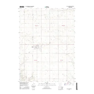
2015 Map of Dallas Center
USGS Topo · Published 2015About this map
Dallas Center serves as the focal point for this section of central Iowa, situated amidst a highly organized grid of rural roads and farmsteads. The town's structured street plan is clearly visible, featuring a primary corridor along Walnut St and a concentration of civic markers. This area is particularly significant for genealogical research, as it contains an unusual density of burial sites for a single quadrangle. These include the Masonic Cem, Saint Marys Cem, and Brethren Cem, reflecting the diverse fraternal and religious communities that settled the Iowa prairie. The landscape is defined by the gentle drainage of Slough Cr and Little Walnut Cr, which transition into the more prominent Raccoon River corridor. The layout of section lines and townships like t80n r27w illustrates the enduring influence of the Public Land Survey System on the Iowa landscape.
Find a feature on this map
49 named features on this map. Tap any name to fly to it.
Don’t see what you’re looking for? This feature index may not catch every label — zoom into the map to look around manually.
Map Details
Editions of this 2015 Dallas Center Map
This is the sole edition of this map. No revisions or reprints were ever made.
Other maps of this area

1908 · Waukee
USGS Topo · 1:62,500

1911 · Madrid
USGS Topo · 1:62,500

1914 · Madrid
USGS Topo · 1:62,500

1949 · Adel
USGS Topo · 1:62,500

1950 · Perry
USGS Topo · 1:62,500

1951 · Perry
USGS Topo · 1:62,500

1951 · Adel
USGS Topo · 1:62,500

1954 · Omaha
USGS Topo · 1:250,000

1954 · Des Moines
USGS Topo · 1:250,000

1956 · Des Moines
USGS Topo · 1:250,000