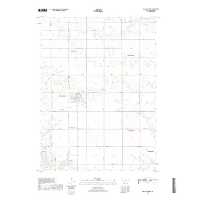
2018 Map of Dallas Center
USGS Topo · Published 2018About this map
Dallas Center sits at the heart of this central Iowa landscape, showing a meticulously gridded town plan defined by streets like Ash St, Walnut St, and Vine St. The surrounding countryside in Dallas County is deeply rooted in its local history, evidenced by a high concentration of pioneer and community burial grounds including Saint Marys Cem, Masonic Cem, and Brethren Cem. To the southeast, the expanding footprint of Waukee begins to appear, signaling the modern growth of the Des Moines metropolitan fringe. The natural geography is shaped by slow-moving drainage systems, with Slough Cr and Royer Cr meandering through the sections, while Little Walnut Cr and Walnut Cr define the eastern reaches of the quadrangle. This 2018 survey provides an essential record for those tracing family plots at Kinnick Cem or Merical Cem within the township and range boundaries.
Find a feature on this map
54 named features on this map. Tap any name to fly to it.
Don’t see what you’re looking for? This feature index may not catch every label — zoom into the map to look around manually.
Map Details
Editions of this 2018 Dallas Center Map
This is the sole edition of this map. No revisions or reprints were ever made.
Other maps of this area

1908 · Waukee
USGS Topo · 1:62,500

1911 · Madrid
USGS Topo · 1:62,500

1914 · Madrid
USGS Topo · 1:62,500

1949 · Adel
USGS Topo · 1:62,500

1950 · Perry
USGS Topo · 1:62,500

1951 · Perry
USGS Topo · 1:62,500

1951 · Adel
USGS Topo · 1:62,500

1954 · Omaha
USGS Topo · 1:250,000

1954 · Des Moines
USGS Topo · 1:250,000

1956 · Des Moines
USGS Topo · 1:250,000