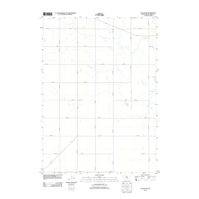
2012 Map of Dallas NW
USGS Topo · Published 2012About this map
Ponca Cr meanders across this rural landscape in Tripp County, carving a subtle drainage pattern through the high plains of southern South Dakota. The terrain is defined by a rigid grid of section-line roads, such as 287th St and 322nd Ave, reflecting the systematic agricultural partitioning of the region. Near the eastern edge of the quadrangle, Roosevelt Lake provides a localized water feature amidst the expansive grasslands. This 2012 survey illustrates the modern road network, including State Route 183, which cuts diagonally across the southwestern corner, serving as a primary transit artery for the sparse farmsteads and ranching operations that characterize this portion of the Ideal Segment.
Find a feature on this map
17 named features on this map. Tap any name to fly to it.
Don’t see what you’re looking for? This feature index may not catch every label — zoom into the map to look around manually.
Map Details
Editions of this 2012 Dallas NW Map
This is the sole edition of this map. No revisions or reprints were ever made.
Other maps of this area

1955 · Mitchell
USGS Topo · 1:250,000

1959 · Mitchell
USGS Topo · 1:250,000

1964 · Dallas SW
USGS Topo · 1:24,000

1964 · Dallas
USGS Topo · 1:24,000

1964 · Paxton
USGS Topo · 1:24,000

1964 · Dallas NW
USGS Topo · 1:24,000

1971 · Colome
USGS Topo · 1:24,000

1971 · Colome SE
USGS Topo · 1:24,000
1982 · Wewela
USGS Topo · 1:24,000

1982 · Winner South
USGS Topo · 1:25,000