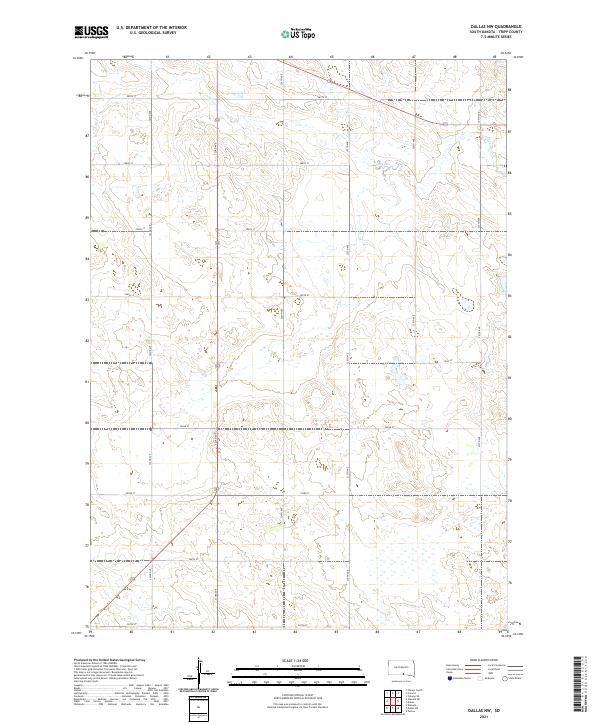
2021 Map of Dallas NW
USGS Topo · Published 2021About this map
Ponca Cr winds through the northern reaches of this landscape in Tripp County, carving a subtle path through the high plains. The terrain is defined by the rigid geometry of the Public Land Survey System, with a dense grid of section lines and local roads like 287th St and 323rd Ave providing access to this agricultural interior. The presence of Hwy 31 and a network of secondary routes such as 327th Ave and 324th Ave highlights the infrastructure required to manage these expansive land tracts. This 2021 topographic record captures the enduring pattern of South Dakota's rural section-line roads and drainage systems, serving as a contemporary reference for land ownership and the natural flow of the watershed.
Find a feature on this map
21 named features on this map. Tap any name to fly to it.
Don’t see what you’re looking for? This feature index may not catch every label — zoom into the map to look around manually.
Map Details
Editions of this 2021 Dallas NW Map
This is the sole edition of this map. No revisions or reprints were ever made.
Other maps of this area

1955 · Mitchell
USGS Topo · 1:250,000

1959 · Mitchell
USGS Topo · 1:250,000

1964 · Dallas SW
USGS Topo · 1:24,000

1964 · Dallas
USGS Topo · 1:24,000

1964 · Paxton
USGS Topo · 1:24,000

1964 · Dallas NW
USGS Topo · 1:24,000

1971 · Colome
USGS Topo · 1:24,000

1971 · Colome SE
USGS Topo · 1:24,000
1982 · Wewela
USGS Topo · 1:24,000

1982 · Winner South
USGS Topo · 1:25,000