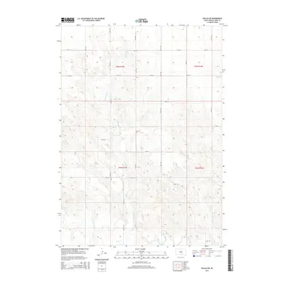
2015 Map of Dallas SW
USGS Topo · Published 2015About this map
The Keya Paha River winds through the southern reaches of this landscape in Tripp County, where its waters are joined by Holt Cr and Jimmie Cr. This 2015 survey reveals a terrain defined by its watercourses and a strict section-line road grid, including 324th Ave and 300th St, typical of the rural Great Plains. A singular cultural landmark, the Gibson Cem, sits centrally near the intersection of 324th Ave and 299th St, serving as a vital point of reference for local family history and genealogical research. The drainage patterns of Rock Bridge Cr, Lute Cr, and Deer Cr illustrate the natural erosion of the plateau as it descends toward the river valley, while Croston Rd provides north-south passage across the undulating plains.
Find a feature on this map
24 named features on this map. Tap any name to fly to it.
Don’t see what you’re looking for? This feature index may not catch every label — zoom into the map to look around manually.
Map Details
Editions of this 2015 Dallas SW Map
This is the sole edition of this map. No revisions or reprints were ever made.
Other maps of this area

1955 · Mitchell
USGS Topo · 1:250,000

1955 · O'Neill
USGS Topo · 1:250,000

1959 · O'Neill
USGS Topo · 1:250,000

1959 · Mitchell
USGS Topo · 1:250,000

1964 · Dallas SW
USGS Topo · 1:24,000

1964 · Dallas
USGS Topo · 1:24,000

1964 · Paxton
USGS Topo · 1:24,000
1964 · Burton
USGS Topo · 1:24,000
1964 · Springview NW
USGS Topo · 1:24,000

1964 · Dallas NW
USGS Topo · 1:24,000