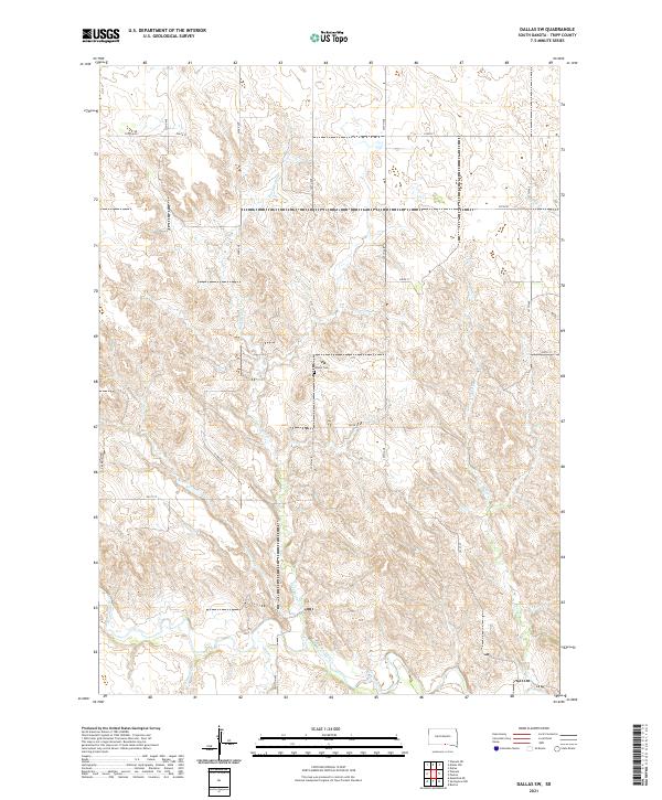
2021 Map of Dallas SW
USGS Topo · Published 2021About this map
The Keya Paha River winds through the southern portion of this Tripp County landscape, serving as a primary drainage point for a network of local tributaries. Notable watercourses including Rock Bridge Cr, Holt Cr, and Jimmie Cr dissect the terrain, creating a series of dissected ridges and valleys characteristic of the northern Great Plains. These features reflect a rural landscape defined by natural drainage patterns rather than dense urban development. Located near the center of the sheet, the Gibson Cem provides a specific point of interest for genealogists and local historians, situated on a high point between the Rock Bridge Cr and an unnamed draw. A grid of section-line roads, such as 324th Ave and 300th St, provides access across the townships, connecting scattered homesteads to the wider region.
Find a feature on this map
25 named features on this map. Tap any name to fly to it.
Don’t see what you’re looking for? This feature index may not catch every label — zoom into the map to look around manually.
Map Details
Editions of this 2021 Dallas SW Map
This is the sole edition of this map. No revisions or reprints were ever made.
Other maps of this area

1955 · Mitchell
USGS Topo · 1:250,000

1955 · O'Neill
USGS Topo · 1:250,000

1959 · O'Neill
USGS Topo · 1:250,000

1959 · Mitchell
USGS Topo · 1:250,000

1964 · Dallas SW
USGS Topo · 1:24,000

1964 · Dallas
USGS Topo · 1:24,000

1964 · Paxton
USGS Topo · 1:24,000
1964 · Burton
USGS Topo · 1:24,000
1964 · Springview NW
USGS Topo · 1:24,000

1964 · Dallas NW
USGS Topo · 1:24,000